Browse Tag

Kalimantan - Page 4

How did the rumours of Kayans practising cannibalism spread?

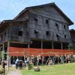
One of the biggest misconceptions of Borneo in the 19th century was that it was a place where cannibalism was common practice.

Plenty of tribes in Borneo were depicted as cannibals in European writing, including the Kayans in Sarawak and Dutch Borneo (Kalimantan).

One account of alleged cannibalism practised among the Kayans was recorded by Sir Henry Keppel.

He received his information from three men named Kusu, Gajah and Rinong from Kapuas.

“I examined them myself, and entertain no doubt of the correctness of these statements, as far as their personal knowledge is concerned. The witnesses themselves stated over and over again, with the utmost clearness, how much they had seen, and how much heard. There was such perfect good faith and simplicity in their stories as to carry conviction of their truth,” Keppel wrote.

How did the rumours of Kayans practising cannibalism spread?
Was cannibalism really being practised in Borneo?
So here is the full testimony of the three men on how they encountered the “cannibalistic Kayans”:

We are of the tribe of Sibaru; which is likewise the name of a branch of the Kapuas river. The tribe of Sibaru contains 2,000 fighting men and is under the government of Pangeran Kuning, who resides at Santang, a Malay town on the Kapuas. We have none of us who resides at Santang, a Malay town on the Kapuas, where the Kayans live, but they often come down to Santang where we meet them. The Kayans are quite independent, very numerous and powerful: they are governed by their own Rajahs, whom they call Takuan. Some of these Kayan tribes are cannibals (makan manusia); it is generally reported, and we know it to be true.

Pangeran Kuning of Santang was at war a few years ago with Pangeran Mahomed of Sewite, a Malay town situated on the Kapuas between Santang and Salimbaw. A large force was collected to attack Suwite. There were Malays (laut) of Santang and Sakadow, and the Dyaks of Sibaru, Samaruang, Dassar and of other tribes; and besides all these, was a party of about fifty Kayans.

We never heard the particular name of this Kayan tribe, for we did not mix with them, not did we understand their language. Suwite was not taken, but a few detached houses were captured, and one man of the enemy was killed in the assault.

Kusu saw these Kayans run small spits of iron, from eight inches to a foot long, into the fleshy parts of the dead men’s legs and arms, from the elbow to the shoulder, and from above the ankle beneath the calf to the knee-joint: and they sliced off the flesh with their swords, and put it into baskets.

They carry these spits, as we all saw, in a case under the scabbard of their swords. They prize heads in the same way as the Dyaks. They took all the fresh off the body, leaving only the big bones, and carried it to their boats, and we all saw them broil and afterward eat it. They ate it with great relish, and it smelt, while cooking, like hog’s flesh. It was not we alone that saw them eat this, but the whole force (bala) saw it.

Men say that many of these interior tribes of Kayans eat human flesh- that of their enemies; most, however, do not, and all of them are represented to be good people and very hospitable; and we never heard that they ate other than the flesh of their enemies. It made us sick to see them, and we were afraid, horrified.

Spencer St John’s records of Kayans practising cannibalism

Just like Keppel, St John did not witness any Kayans practising cannibalism during his time in Sarawak.

However, according to St John, a Malay nobleman named Usup told him that he actually witnessed it.

In 1855, men from Mukah had been executed in Bintulu. A few of the Kayans who helped in their capture took portions of the bodies of the criminals, roasted and ate them.

St John wrote, “This was witnessed by himself and many others who were then present. The Kayans had not, as a body, joined in this disgusting feast; but, perhaps some of the more ferocious may practice it to strike terror into their enemies.”

How did the rumours of Kayans practising cannibalism spread?
Records that the Kayans did not practice cannibalism

Not everybody believed that Kayans practised cannibalism.

Sir Hugh Low wrote that the Kayans were hastily stigmatised as cannibals and added: “nor does any race practicing the horrid custom of feeding on the bodies of their own species, exist on the island.”

The Kayans might not have been the second Rajah of Sarawak Charles Brooke’s favourite tribe, but he never believed that they were capable of cannibalism.

How did the rumours of Kayans practising cannibalism spread?
Here is what he wrote about the Kayans and cannibalism in Borneo:

“This tribe are cowardly, untruthful, and treacherous, and are capable of committing many horrors, but the gravest attached to the Kayans, I feel confident, is without foundation, namely, that of cannibalism. For, during the expedition of 1863, there was no sign of it, and I had abundant opportunities of making strict enquiry in the very heart of the country.

“Many reports of this description are spread by the enemies of a people to degrade them in the estimation of Europeans. Such reports are purely fabulous, and I do not believe any tribes are cannibals in this part of Borneo, although stories go far to lead one to a contrary belief.”

However, a group of Malays told the Rajah that they did see pieces of human flesh in bamboo during a visit to Kapuas region and that they were used as provision.

“I regret that I am unable positively, to contradict such statements; but it is my firm conviction cannibalism is not practiced on any part of the island of Borneo,” Brooke wrote.

Do bear in mind that all written reports of alleged cannibalism among Kayans were written by the Europeans after listening to secondary sources. Thus, some information might have gotten lost in translation. None of these 19th century writers had actually seen any Kayans eating human flesh.

Another theory was that this rumour was spread by the local guides to discourage the Europeans from travelling further inland of Borneo.

Imagine refusing to bring your client to a place by telling them it is full of cannibals.

5 things to know about Kayan river, North Kalimantan

While in Sarawak we have Batang Kayan river in Lundu, in North Kalimantan they have their own Kayan river too.

North Kalimantan borders the Malaysian states of Sabah to the north and Sarawak to the west, and by the Indonesian province of East Kalimantan to the south.

Although they both flow on the same island of Borneo, both rivers are located at the opposite sides of each other.

Malaysia’s Batang Kayan is at the western tip of Sarawak while Indonesia’s Kayan river flows in the north eastern side of Kalimantan.

Here are 5 things to know about North Kalimantan’s Kayan river:
5 things to know about Kayan river, North Kalimantan
The view of Kayan river during sunrise.
1.Kayan river stretches for 576km.

Sarawak’s Batang Kayan is 125km long while the one in North Kalimantan province is way longer at 576km. It flows from Mount Ukeng, passing Tanjung Selor city and discharges into Sulawesi Sea.

Tanjung Selor city is the capital of North Kalimantan province and also the capital of Bulungan regency.

2.It is the main transportation route for the peoples in inland regions of North Kalimantan.
5 things to know about Kayan river, North Kalimantan
River transportations such as this speed boat plays an important role for the people who lived along Kayan river.

Most of the settlements in North Kalimantan are not well connected with road networks. So the communities living particularly in Malinau and Bulungan regencies use river transportation such as traditional boats and speedboats to commute.

The ports in Tarakan offer ferry transportation services to Tanjung Selor around the clock from morning to evening via Kayan river.

Plus, it is the main route for goods and other supplies to enter this inland regions of North Kalimantan.

Otherwise, most of North Kalimantan residents, especially those who live at the Sabah-Sarawak border may rely on trading with Malaysia for supplies.

3.It was named after the Kayan people who live along the river.
5 things to know about Kayan river, North Kalimantan
The river was named after the Kayan people who lived along the river.

In Kalimantan, the Kayan people live along the upper Kayan and the middle Kapuas and Mahakam rivers.

Meanwhile in Sarawak, they settled along the Baram, Balui, Belaga, Tubau rivers.

4.Along the Kayan river was where the Sultanate of Bulungan reigned.

Speaking of the Kayan people, here comes an interesting story of how the ethnogenesis of Bulungan people was formed.

Long time ago, there was a group of Kayan people from Uma Apan in the interior region of Apo Kayan highlands.

They expanded their territory and then settled down near the east coast of Kalimantan.

Around 1650, a princess of the group married a man from Brunei. The marriage founded a Hindu lineage which settled in Tanjung Selor.
About a century later, the dynasty converted to Islam and the rulers took the title of Sultan.

The last Sultan Jalaluddin passed away in 1958 and the Sultanate was subsequently abolished in 1959. Now the territory is a kabupaten or regency.

5. It is one of the main rivers flowing through Kayan Mentarang National Park
5 things to know about Kayan river, North Kalimantan
Kayan Mentarang National Park is accessible by longboats via Kayan river.

Located at the border between Indonesia and Malaysia, Kayan Mentarang National Park is one of the few places in Borneo which is densely forested.

It is also a fundamental site to the WWF Heart of Borneo. It is an initiative which aims to protect the transboundary biodiversity of Borneo.

Animals found in the park include Malayan pangolin, long-tailed macaque, Bornean gibbon, clouded leopard, different kinds of hornbills and many more.

So if you are heading to the park via Kayan river, you might be lucky to appreciate some of these endangered species along the way.

How the Bornean rhinoceros was hunted to extinction in Sarawak

In the beginning of 20th century, the Bornean rhinoceros was common in Sarawak.

Also known as the Eastern Sumatran rhinoceros or Eastern hairy rhinoceros, it was one of the three subspecies of Sumatran rhinoceros.

Its subspecies name (Dicerohinus sumatrensis harrissoni) was named after British anthropologist and Sarawak museum curator Tom Harrisson.

Compared to other Sumatran rhinos, the Bornean rhinoceros has the darkest skin and the fur on its calves is much denser.

Unlike the other two subspecies, the Bornean rhinoceros is markedly smaller and its head size also relatively smaller.

Rhinoceros in Borneo during prehistoric times

When sea levels fell during the Late Miocene period, between five and seven million years ago, Sundaland probably stood above the sea once again.

These mammals included primitive rhinoceroses, elephants, and monkeys. In detail, these forests may have looked somewhat different from the forests we see today.

According to Hans P. Hazebroek and Abang Kashim Abang Morshidi in National Parks of Sarawak, many animals that were widespread across the Asian continent may have reached Borneo at this time.

When the sea level rose during the early Pliocene Epoch, Borneo turned into a huge island again. So the mammals that reached Borneo stayed here and continued to evolve in isolation.

How the Bornean rhinoceros was hunted to extinction in Sarawak
The primitive rhinoceros most probably came to Borneo five to seven million years ago.
Edward Banks’ account on rhinoceros hunting in Sarawak during the 1930s

While the primitive rhinoceroses survived their journey into Borneo, most of their descendants did not survive long enough on this island.

Over the past century, this animal was highly threatened by hunting, poaching for their horn and habitat loss.

Even during the 1930s, Sarawak Museum Curator Edward Banks described how the rhinoceros population in Sarawak had been greatly reduced.

In an article published on The Sarawak Gazette on Aug 2, 1937, he wrote, “Fifty years ago anyone who shot a rhino was rather disappointed; he couldn’t eat it all, it was too far to carry home, and the most that could be obtained from it was an occasional sword hilt made from the horn; these can still be obtained at a fabulous price.”

According to Banks, a rhino in the 1930s may fetch anything up to $300-$400. He pointed out, “Its horn being the most useful part but the blood and flesh also fetch a price, solely on account of the supposed aphrodisiac properties appreciated by the Chinese.”

Banks also highlighted areas in Sarawak that had high number of rhinoceros populations included Ulu Rejang, Ulu Baram and Ulu Trusan.

“There are almost none now and in fact after a prolonged visit to the Ulu Trusan into a once populous rhino country, I saw only once a trace made about three years ago and nothing else under five years ago,” Banks wrote in 1937.

He continued, “A once populous rhino district has been wiped out by the Dayaks and one can only feel that it is a good thing that no rhinos have strayed in during the last five years and attempted to repopulate the district as they would have assuredly gone too.”

Hunting Bornean rhinoceros

The museum curator also commented on how different ethnics hunted these rhinoceros. The Punan was “an uncontrollable curse until he had finished all the rhinos”. Meanwhile, the Kayans and Kenyahs “were, as usual, reasonable, shared their beasts out among themselves, and made them last, until they finally took up a little over the garden wall poaching.”

Nonetheless, the ones that brought more harm to the rhinos were the wandering bands of professional Dayak hunters.

Banks described them to be really persistent, stating “..(they) stay on the beast’s tracks from fifteen to twenty days until they catch it up.”

Even during the 1930s, there were no bands of hunters because there were no more rhinos.

Back then there were only few individuals on Mulu, Murud, Laiun and Tibang mountains. If there were odd ones that showed up in Baram and Trusan, there were the strays coming over from the Kalimantan side.

Hazebroek and Abang Kashim also pointed out, “It is reputed that the last rhinoceros in Mulu was hunted and killed just before the Second World War. Once these magnificent animals must have been quite common in Mulu. As indicated by Berawan guides, large pools on some ridges of Gunung Mulu presumably represent their wallows.”

Sarawak’s last rhinoceros is at Pulong Tau?

Pulong Tau is an area flanks the Bario highlands. It straddles part of the headwaters of the Baram, Tutoh and Limbang rivers.

In 1986, the National Parks and Wildlife Office staff sighted rhinoceros tracks and wallows in the area.

Then in 1997, they disovered rhinoceros tracks again but there were no sightings of the animals.

Regardless, the Malaysian government declared the Bornean rhinoceros to be extinct in the wild in Malaysian Borneo.

In March 2016, however, a young female rhino was captured on the other side of Sarawak border in East Kalimantan. Hence, this gives us hope that they still exist in the wild.

Is it fair to say that Sarawakians were the ones who drove the rhinoceros into extinction in our own backyard? We believe so.

In Banks’ own words, “It is not too much to say that the rhino has been immolated to provide the Chinese with babies, the Dayak hunters with patent leather shoes and their girlfriends with silk umbrellas.”

What you need to know about the Battle of Tarakan during World War II

The Battle of Tarakan refers to different actions which happened during World War II on Tarakan island, off the northeast coast of Borneo.

The first battle of Tarakan happened on Jan 11-12, 1942 when Japanese attacked the island, defeating Allied forces. Meanwhile the second battle of Tarakan took place on May 1-25, 1945 as the first phase of the Allied campaign to retake Borneo from the Japanese.

Battle of Tarakan (1942)
What you need to know about the Battle of Tarakan during World War II
A view of Amal Beach, east coast of Tarakan.

The Battle of Tarakan in 1942 began a day after the Empire of Japan declared war on the Netherlands.

Despite the fact that it is only a small island, Tarakan’s 700 oil wells, oil refinery and airfield put the island onto the Japanese forces must-conquer-list during the Pacific War.

Before the war, Tarakan was producing about 80,000 barrels of oil per month.

On Jan 10, 1942, a Dutch flying boat spotted an approaching Japanese invasion fleet. Knowing the Japanese army was coming, the commander of Tarakan’s garrison ordered the destruction of all oil installations on the island.

Today, one can only imagine the sounds and smells of these explosions as well as the anxiety waiting for your enemies to land.

By midnight of Jan 11, the Japanese forces landed on the east coast of Tarakan which today has become a tourist attraction called Amal Beach.

The troop was met with short but fierce resistance from the Royal Netherlands East Indies Army. The Dutch surrendered in the morning of Jan 12.

Instead of accepting their surrender, the Japanese executed the entire crew of coastal battery together with some 219 prisoners of wars (POWs) via drowning.

The island then remained under Japanese occupation until May 1945 when the Battle of Tarakan 1945 happened.

What you need to know about the Battle of Tarakan during World War II
Amal Beach, where the Japanese landed in 1942.
Tarakan under Japanese occupation

The Dutch thought they did a thorough job in destroying Tarakan’s oil fields. But the Japanese were able to recommission the first oil wells by August 1942. By early 1944, Tarakan was producing 350,000 barrels a month.

During the Japanese occupation, the locals of Tarakan suffered from malnutrition. The large number of Japanese troops on the island together with 600 Javanese labourers caused food shortage on the island.

Imagine that the oilfield in Tarakan alone was operated by 250 men from the Imperial Japanese Navy.

By late 1944, the Allied forces started to strike back, launchinf air raids destroying oil production and storage facilities on the island.

Unfortunately, hundreds of civilians were also killed during these air raids.

Comfort women in Tarakan during Japanese occupation

If you are not familiar with the term ‘comfort women’, they were women and girls forced into sexual slavery by the Imperial Japanese Army.

The Dutch government did a study in 1994 about comfort women during the time of the Dutch East Indies.

It concluded that about 200 to 300 European women had been taken to become comfort women.

Besides Dutch women, many Javanese and east Timorese women were also forced into prostitution.

They were usually sent to Burma, Thailand and eastern Indonesia, including Tarakan.

According to records, it is estimated about 300 women from Java were brought into Tarakan. A number of them were of other origins including Eurasians and Chinese.

Similar to many human trafficking cases today, they had been lured with the promise of jobs in clerical work and clothes making.

But in the end, they were actually forced into prostitution at Tarakan’s garrison and sometimes on visiting warships.

Battle of Tarakan (1945) was just a political act?

Many historians believed the decision by the Allies to retake Borneo from the Japanese in 1945 was mostly based on political reasons.

According to an article by Department of Veterans’ Affairs in Australia, the plan to invade Borneo had only marginal strategic value.

It stated, “General Douglas MacArthur, Commander-in-Chief of Allied forces in the Southwest Pacific Area, planned the operation to alleviate concerns of the Australian government that its forces were being relegated to operational backwaters as New Guinea had become.”

During the war, MacArthur left Australian forces out of most significant operations.

So, the idea of invading Borneo was intended to make Australian forces more visible again during the war against Japan.

General MacArthur chose to capture Tarakan in order for the island to be used to support an invasion of Java. It was crucial to recapture Java so that the Dutch could formally restore its power on the Netherlands East Indies.

Another reason was to capture the oilfields in Borneo. But this did little effect on the Japanese operation. Taking Tarakan, for example, the last Japanese oil tanker left the island in July 1944.

Meanwhile, the American air and naval troops had blockades around Japan. So there was no oil being shipped into Japan from Borneo.

What went down during the Battle of Tarakan 1945

Regardless of the reasons, the Battle of Tarakan was the first stage in the Borneo campaign of 1945.

In an operation code-named Operation Oboe One, the Australian forces landed on Tarakan on May 1.

The engineers went in first and cleared gaps through the beach defences with explosives before the main assault.

Then, naval and air bombardments also destroyed or damaged many Japanese positions.

Over the next seven weeks, there was fierce fighting as the Australians pushed inland to take the whole island.

One of the primary objectives to retake Tarakan island was to build airfields.

The airfield did open for fighter aircraft to land in late June 1945 but it was not used as much as it was intended for.

The Australians underestimated the work as they found the existing airfields were badly damaged. Meanwhile the site selected to build new airfields had excessive boggy ground.

The Aftermath of Battle of Tarakan

In the end, more than 200 Australians were killed before the last Japanese positions fell on June 20, 1945.

Although the Battle of Tarakan in 1945 was a success for Australia, Australian historian Gavin Long pointed out that the results achieved did not justify the entire cost of the Tarakan operation.

So was the battle for a sideshow? Or was it to make Australia look like they contributed something during the end of WWII? The Battle of Tarakan 1945 remains debatable among historians.

What you need to know about the Kedang Expedition 1886

When second White Rajah, Charles Brooke visited Simanggang in June 1885, the Iban chiefs there complained to him that the Lemanak and Skrang peoples were constantly being attacked by those living near the Kedang ridge on the border between Sarawak and Dutch Borneo.

According to the Sarawak Gazette report published on Mar 7, 1949, the conflicts had continued off and on for almost 20 years.

So Charles decided to put an end to it. Somehow, he believed that the only decision he could make was to attack the Kedang people. But, of course, not without the permission from the Dutch government to cross the border.

He sent a letter to the Dutch, together with maps of longhouses for his punitive expedition.

At first, a Dutch officer suggested a joint attack on these Kedang areas. But Charles rejected the motion, believing his force was better than the Dutch.

Finally, in October 1885, the Rajah received a favourable reply from the Dutch. They allowed him to bring his mostly Iban forces to attack Kedang.

After discussions with the local chiefs, the Brooke government decided to assemble at the mouth of Lingga River during the new moon in March, 1886.

On the evening of March 8, they held a council of war to discuss their strategy. The Brooke government planned on targeting the Ibans living in the upper Delok (Sarawak), the Kedang ridge (on both sides) and in the Lanjak area (Netherlands Indies).

The next morning, a force of 355 boats with 10,000 to 12,000 fighting men came together, heading to Kedang. They finally made a landing on March 12.

After climbing for some hours, they finally came across Iban Kedang farming grounds.

The Kedang Expedition war plan

The government plan was to divide the force into four detachments with each group consisting about 2,500 men.

A man referred to as Orang Kaya Pemancha in the report was the leader of the first group. This detachment headed to Gunung Lanja to lay waste all that line of country, avoiding Lake Sariang and Badau.

Meanwhile, the second group was led by an Iban chief named Minggat. Charles instructed them to burn and destroy everything they came across along the Kedang ridge.

Another Iban chief named Jabu led the third detachment. They were to march across the Kedang ridge but back by another path via Miniang stream.

Lastly, the fourth group was to stay at the camp. Their task was to burn houses near the camp, destroying anything they could not carry and gather ripe paddy. Soon enough, the camp was full of rice, pigs, poultry, dogs and valuable jars.

Minggat’s group was the first to return to camp on the March 19. They reported they destroyed 37 longhouses without losing any men.

Then, Orang Kaya Pemancha returned on March 25, reporting that his force had burnt eight longhouses and plundered everything they could carry.

The last group to return was Jabu’s. While the official number of the longhouses they burned was not recorded but it was the only the party that fell short.

Overall, the total number of longhouses destroyed was not less than 80 and the amount of havoc “quite beyond computation”.

The Dutch’s reaction to the aftermath of the Kedang Expedition

The Dutch reportedly were very unsatisfied with the manner in which the expedition was carried out, especially the rampant raiding and looting conducted by the Iban mercenaries and their attacks on several Iban longhouses that the Dutch regarded as friendly.

Before the expedition, the Dutch requested that Charles inform them of his plans in time so that they could protect the Emperan Iban they regarded as well-disposed and prevent them from giving aid to their kin who were to be attacked.

Since it was a time when there was no WhatsApp, the Dutch complained they received the letters from Sarawak on the expedition plan quite late.

The Dutch resident in Pontianak, Resident Gijsberts only received Charles’ letter (dated on Feb 25) on March 10.

Meanwhile the controleur in the area received a letter from Sarawak resident (dated March 3) on the 12th. He reportedly rushed to protect any longhouses that he could.

In the meantime, Gijsberts arrived in the area with soldiers from Pontianak and Sintang. They were able to protect the longhouses of their district headman at Lanjak.

Once the Kedang Expedition returned to Sarawak, the Dutch counted 41 burned longhouses on their territory with at least 13 of which were considered friendly. There were also 16 dead, including some women and children.

Michael Eilenberg in his book At the Edges of States stated that in order to handle the problem after the expedition, the Dutch created a new district (Onderafdeeling Batang Loeparlanden) in the borderland. They then permanently stationed a Dutch district officer (controleur) in the area. They also increased the number of soldiers at the border post in Nanga Badau.

In the end, Iban leaders on both sides of the border tendered their submission to the Dutch and the Brookes respectively.

On the Dutch side, their government gave the Iban two conditions for submission. First, they had to pay a fine as a promise to stop raiding. Secondly, all longhouses upriver affected by the Kedang expedition had to move away from the border into specific territories further downriver.

What you need to know about the Kedang Expedition 1886
Nanga Badau Border Post in current day.
Sarawak defended its action during Kedang Expedition
What you need to know about the Kedang Expedition 1886
Charles Brooke (left) and map showing the route of Kedang Expedition. Credits: Reed L. Wadley.

Reed L. Wadley in his paper “Trouble on the Frontier: Dutch-Brooke Relations and Iban Rebellion in the West Borneo Borderland (1841-1886)” analysed the complex relationship between these two governments.

Later in early April, Resident Gijsberts met who his Sarawak counterpart, Henry Deshon in Pontianak to discuss about the matter.

Logically, the first question the Dutch asked was whether Sarawak purposely sent the letters late.

Deshon, who was present during the expedition, maintained his innocence about the late arrival of the letters. Furthermore, he said the map, submitted by Charles indicated the target area within Dutch territory was inaccurate.

Gijsberts then pointed out around 20 longhouses in the Kedang and Delok areas were still left standing, casting in doubt Sarawak’s claims that the expedition was completely successful.

“For their part and reflecting Brooke’s feeling that the Dutch were weak in the dealing with the Iban, Deshon offered to post an agent in West Borneo to advise the Dutch on Dayak matters, something the Dutch rejected outright,” Wadley wrote.

What a way to tell someone that they were incompetent in their jobs by posting one of your own in other people’s territory.

Wadley continued, “However the continual acrimony and distrust (expressed publicly and no doubt even more strongly in private), the Dutch realised that the close cooperation with Sarawak was important for keeping the border Iban in check.

“Resident Gijsberts even wrote to the Governor-General in Batavia that he preferred their present, rocky relationship with Sarawak to that with the Iban.”

Furthermore, after 1886 and possibly because of the Kedang Expedition, Sarawak-Netherlands Indies relations seem to have improved.

Wadley added, “There were generally fewer complaints by Dutch officials to their superiors about Sarawak cooperation, and there appears to be more cooperation in arresting and extraditing cross-border troublemakers.”

What you should know about the Ligitan and Sipidan dispute

The Ligitan and Sipadan dispute was all over media headlines during the late 90s and early 00s in Malaysia.

It was a territorial dispute between Indonesia and Malaysia over islands in the Celebes Sea, namely Ligitan and Sipadan.

The location of Ligitan and Sipadan islands

Sipidan lies to the south of Mabul island and southeast of Kapalai island. While the distance from the Malaysian mainland at Tanjung Tutop on the southeastern coast of Sabah is 14 nautical miles, the nearest distance to Indonesian territory is 40 nautical miles.

The island overall is uninhabited, but it has a small reservoir of fresh water. Fishermen and turtle eggs collectors from nearby Dinawan island have visited this island on a regular basis.

Conservation-wise, Sipadan was declared a bird sanctuary by the colonial government of North Borneo in 1933. Then it was re-gazetted in 1963 by the Malaysian government after the formation of the Malaysian federation.

Since 1988, the Sabah Department for Tourism and Environment built a wildlife preservation office on the island and issued licenses to erect small chalets and beach huts for a scuba-diving resort.

Meanwhile, Ligitan island lies east of Sipadan island. To the west of Ligitan is the Indonesian part of Sebatik island at a distance of 55 nautical miles. Meanwhile, the nearest Malaysian territory is Pulau Dinawan at the northern tip of Ligitan reef with the distance of 8 1/2 nautical miles.

Just like Sipadan, Ligitan is also uninhabited with only a few low bushes growing on it.

The origin of the Ligitan and Sipadan dispute

The first publicly known Ligitan and Sipadan dispute happened in 1982 when an Indonesian naval patrol appeared near Sipadan island to investigate foreign troops. Both the Malaysian and Indonesian governments reportedly tried to play down the incident, discouraging press coverage.

Then in 1991, Indonesia discovered Malaysia had built some tourist facilities on Sipadan island. The Indonesian government claimed that it had made a verbal agreement with Malaysia in 1969 to discuss the sovereignty of the islands.

Indonesia argued based on the 1891 Convention Between Great Britain and the Netherlands Defining Their Boundaries in Borneo. This was when Sabah (then North Borneo) was under Great Britain while Kalimantan was part of Netherlands’ territory.

Based on this convention, both Ligitan and Sipidan islands would be considered within Indonesian waters.

Furthermore according to the Indonesian government, after the Indonesian-Malaysian Confrontation (1963-1966), both countries established their continental shelf boundaries in the Straits of Malacca and the South China Sea by treaty.

More evidence to support Indonesia’s case was a map in 1967 by the Indonesian Armed Forces showing both islands lying within the Indonesian claim.

Malaysia on the other hand denied the allegation of an agreement between the two countries, maintaining Ligitan and Sipidan had always been part of Sabah.

Finally on Nov 2, 1998, Indonesia and Malaysia agreed to bring the matter to the International Court of Justice (ICJ).

The court decision on the Ligitan and Sipidan dispute

What you should know about the Ligitan and Sipidan dispute
A map of British North Borneo in 1888 where Ligitan and Sipidan fell under Province Elphinstone. Credit: The British Empire

In the Ligitan and Sipidan dispute, ICJ ruled in Malaysia’s favour due to the country’s effective occupation over the islands.

Plus, it also noted that Indonesia or even the Netherlands previously, had never issued a formal protest with Malaysia (or Britain) when those activities, such as construction of the lighthouse at Ligitan or the declaration of Sipadan as a bird sanctuary – were carried out.

Additionally, the court acknowledged that both of the islands were much closer to Malaysia than Indonesia.

While the Indonesian claim was mostly based on the 1891 Boundary Treaty, there was earlier documentation which supported the Malaysian claim. It was the British 1878 Agreement with the Sultanate of Sulu during which time they acquired the Sultanate area as part of British North Borneo.

The massacre of Sarawak officers at Long Nawang during WWII

When news of Japanese troops coming to attack Sarawak broke out, the Chief Secretary put out instructions requiring all Brooke officers to remain at their stations.

However, a group of Sarawak officers decided to flee the kingdom and head to Dutch Borneo. Their decision to take refuge near the border of current day Kalimantan led to what most historians called the Long Nawang Massacre.

The journey to Long Nawang from Sibu

According to local historian Ooi Keat Gin, the Brooke officers in the Lower Rejang fled in a party of 26 men, three women and two children who were aged nine months and five years old.

The party was led by Andrew Macpherson, Resident of the Third Division. He brought along his wife who was then six-months pregnant. Other Brooke officers in the group included Sibu, Kanowit and Kapit district officers.

Ooi wrote, “Macpherson’s plan was to go up the Rajang, cross over into Dutch Borneo to Long Nawang, a Dutch military outpost.

“The party reached Kapit by motorboat, negotiated the Pelagus Rapids to arrive at Long Bahau above Belaga. They stayed at Kenyah longhouses along the way. After Belaga, smaller and lighter boats brought them through the shallower, rapid-infested headwaters of the Ulu Rejang.”

After 28 gruelling days of crossing treacherous mountains on Jan 22, 1942, the group finally arrived at Long Nawang, which was also a Kenyah settlement.

There, the party had the comfort of a four-bed hospital with an adequate supply of medicine. Furthermore, they had enough food supply to last for a year.

Macpherson and his team separate at Long Nawang

After arriving at Long Nawang, Macpherson who was suffering from malaria, decided to stay there. However, he allowed the rest to proceed and carry on their plans.

So four men – Jacks, Schotling, McKerracher and T.E Walter – decided to go to Long Iram and then Samarinda.

The men reached Samarinda and managed to board a plane to Bandung. Somehow Jacks and McKerracher eventually reached Perth while Walter and Schotling were captured and imprisoned by the Japanese.

Meanwhile another group of Brooke officers unfit to travel decided to return to Belaga. There, they were eventually taken into custody and interred at Batu Lintang POWs Camp. They may have had a better fate than those who stayed behind at Long Nawang.

The other refugees of Long Nawang

Besides Macpherson and his team, there was another group of Brooke officers and a missionary priest from Marudi who made their way to Long Nawang.

According to retired Mill Hill Missionary priest Theo M. Feldbrugge, he had a paternal uncle who was a Mill Hill priest during World War II.

The older Rev Feldbrugge was the parish priest of Marudi. Together with Resident of Marudi Mr Hudden and a few other British officers, they decided to go to Kalimantan to seek refuge.

“So they walked up to Baram and by boat and then they walked all the way to Long Sang, Long Nakang and across the mountains down the riverside till finally they ended up in Long Nawang.”

The arrival of Dutch and Indonesian soldiers

In April 1942, Lieutenant D.J.A Westerhuis arrived at Long Nawang along with 40 Dutch and Indonesian soldiers.

Four months later, two Kenyahs brought the news that more than 70 Japanese soldiers were on their way to Long Nawang.

But Westerhuis did not believe that the Japanese would ever discover their hideout.

Rev Feldbrugge pointed out that Long Nawang was at the very head of the Mahakam river in Indonesia which went to Balikpapan.

“And they thought the Japs would never come. But the Japs were in Balikpapan and they were told God knows by whom that Orang Putih were there in Long Nawang.”

So the Japanese came up to Long Nawang, trickling in via Mahakam river.

The massacre

On August 20, 1942, about 76 Japanese marines led by Captain Mora Shima arrived at Long Nawang attacking the border post with mortars, light machine guns and rifles.

Many were killed during the attack. The Japanese rounded up the surviving Europeans, imprisoning them while they allowed the Indonesian soldiers to return to their military post at Tarakan.

There were at least two eyewitnesses for what happened next; Corporal Tamburiang and Private Markus who were former native polices living in Long Nawang were executed on Aug 26 and buried in two graves.

Then a month later on Sept 23, the Japanese massacred all the women and children.

Another witness, Tusau Padan who was 11 years old at that time saw how the execution of the children took place.

The young children were forced to climb palm trees. Then they were impaled on the upraised bayonets when they slipped down in exhaustion.

All the women and children were buried in one grave.

After the war, the victims of Long Nawang massacre were exhumed and reburied on Tarakan island at Makam Pahlawan.

There have been requests by the descendants of the massacre victims to bring them home from Tarakan to Sarawak.

Among them were the grandchildren of Desmond Vernon Murphy, a British officer serving as Assistant Superintendent of the Sarawak constabulary and Sarawak Rangers.

Murphy was one of the officers who joined Macpherson to Long Nawang and later executed. His grandchildren wanted him to be buried in the Heroes Graves in Kuching so that it would be easier for them to visit to pay their respects.

The massacre of Sarawak officers at Long Nawang during WWII
Tarakan War Cemetery after the dedication on Oct 9, 1945. Photographer: Lt W. N. Prior.
Credit: Public Domain (Copyright expired).
Why did the Japanese massacre the refugees of Long Nawang?

It took the Japanese alone four weeks to reach Long Nawang. Having to travel out of the area with the more than 40 prisoners including women and children along would have taken them even longer.

For the Japanese troops at that moment, it was more expedient to kill the prisoners right there in that thick jungle.

Another reason why they were killed was because, for the Japanese, the refugees were considered enemy fugitives (even Macpherson’s newborn baby).

Ooi wrote in his book The Japanese Occupation of Borneo, “The fact that the refugees at Long Nawang did not voluntarily surrender themselves as was the expectation of the Japanese military authorities following the establishment of a new regime in Borneo made them, legally speaking, enemy fugitives.”

He added that from this perspective their execution was in line with wartime military requirements.

As for Captain Shima, the man who was responsible for the Long Nawang Massacre? There were no traces of him after WWII, and so he was never persecuted for his war crimes.

Saying hello to the proboscis monkey in Tarakan’s Bekantan and Mangrove Conservation Park

While we call it’ ‘monyet belanda’ in Malaysia, in Indonesia it is called ‘bekantan’. The proboscis monkey (Nasalis larvatus) is endemic to Borneo and can be found in all three countries on the island.

But it can also be found on the island of Tarakan, in the eastern part of Borneo in North Kalimantan province of Indonesia.  

Here visitors can see them at the Bekantan and Mangrove Conservation Park, about 1km from the city center of Tarakan.

The Bekantan and Mangrove Conservation Park

The park is a conservation effort led by Tarakan city’s local government. In the beginning, the area only spanned three hectares, now it has increased to 22 hectares.

It was officially opened on June 5, 2003. Besides a conservation place for proboscis monkeys, it also served as the green lung for Tarakan city.

At first there were only two proboscis monkeys living in the park, now they have about 35 individuals.

Over the years, these proboscis monkeys have become used to human visitors, so it is easier to spot them and catch them on camera.

Plus, their reddish brown fur and unusually large noses make them easier to spot among the mangrove trees.

The best times to visit the Bekantan and Mangrove Conservation Park are between 11am to 2pm. This is because these are the extra feeding times for these bekantan.

Being seasonal eaters, these animals eat mostly fruit from January to May and leaves, especially mangrove leaves during June to December.

But the park rangers still feed them fruit with extra nutrients like bananas.

What to bring to the park

Visitors can walk around the park along its walkways that make it convenient to bring young families around.

Besides proboscis monkeys, visitors can also watch out for other animals such as crabs, birds, monitor lizards, squirrels, and mud fish. During high tide, you might even spot see snakes swimming through these mangrove roots.

Since the park is located near the city, visitors cannot escape from urban noise pollution, especially with noises coming in from a nearby school.

But with plenty of mangrove trees around, it is still a good place to see some greenery.

Although you can take photos of proboscis monkeys from a distance of 5m, it is still best to bring long-focus lenses to take their photographs.

Be respectful toward these animals and do not provoke them. Ever.

In Indonesia, proboscis monkeys are protected by Law Number 5 of 1990, Article 21, paragraph 2, which states that it is prohibited from capturing, injuring, killing, storing, possessing, maintaining, transporting and trading protected animals in living conditions. Anyone who intentionally violates the provisions of Article 21 paragraph 2 can be punished with a maximum imprisonment of 5 years and a maximum fine of Rp100 million (about RM28,000 or USD 7,000).

Besides Bekantan and Mangrove Conservation Park, proboscis monkeys can also be found in 16 protected areas in Indonesia.

These include Danau Sentarum National Park, Gunung Palung National Park, Kendawangan Nature Reserve, Kutai National Park, Lesan Protection Forest, Muara Kama Nature Reserve, Mandor Reserve and Tanjung Puting National Park.

Hiking up the hill of legendary Lundayeh hero Upai Semaring

The mystical story of Upai Semaring (spelled as Yuvai Semaring in Indonesia) is unlike other local legends. It transcends international boundaries, from the Kelabit Highlands of Sarawak, to Long Pa’ Sia in Sabah and even to Brunei.

However, his legend started from theKrayan Highlands in North Kalimantan, Indonesia.

Hiking up the hill of legendary Lundayeh hero Upai Semaring
Signage leading up to Yuvai Semaring hill which measures 1,103 dari permukaan laut (above sea level).

The legend of Upai Semaring in Krayan

Hiking up the hill of legendary Lundayeh hero Upai Semaring
Visitors need to cross a traditional makeshift bridge consisting of logs before making their ascent up the hill.

Since stories of his legendary exploits can be found among the Lun Bawang people in Sarawak and the Lundayeh people in Sabah, here is the Krayan Highlands’ version of Upai Semaring.

According to local guide Alex Ballang, Upai Semaring once lived in a cave on a hill in Long Bawan.

Upai Semaring was considered a local hero because of his fierce defense of the people, taking his stand on the top of this hill looking out for the enemy. (The hill became synonymous with him that it was named Yuvai Semaring hill or ‘bukit Yuvai Semaring’.)

Back in those days, headhunting was rampant. The hill worked as a watch tower for Upai Semaring looking out for headhunters from what we know as Sarawak and Sabah today.

Even before the enemy could even reach the Krayan Highlands, he would warn his people to be prepared. So the people of Krayan were always able to defeat their enemies.

Hiking up the hill of legendary Lundayeh hero Upai Semaring
A flag pole on the top of Yuvai Semaring hill.

Upai Semaring: An ancestor of current day Brunei Sultanate?

Hiking up the hill of legendary Lundayeh hero Upai Semaring

After some time, Upai Semaring left Krayan to explore, ending up in several places including Ba Kelalan, Long Pa’ Sia and Brunei.

In Brunei, there are many stories of how Upai Semaring became the ancestor of the Brunei Sultanate.

One legend has it there was a huge dragon living on the coast of Brunei, guarding a pearl. A king in Brunei offered up his daughter’s hand in marriage to anybody who could retrieve the pearl .

Since Upai Semaring was a giant, he was able to defeat the dragon and get the pearl. He married the princess, and it is believed that Upai Semaring’s descendants are today’s Brunei royal family.

Another version of the story has it that he was known as Awang Semaun in Brunei.

The sultan of Brunei back then was very fascinated by Awang Semaun’s strength that he offered one of his daughters to him in marriage.

Hiking up the hill of legendary Lundayeh hero Upai Semaring
The view of the summit from where Upai Semaring watched for his enemies.

Upai Semaring, the mystical blacksmith

Hiking up the hill of legendary Lundayeh hero Upai Semaring
The morning mist covering the top of the Krayan Highlands

Upai Semaring is renowned for his mystical powers; one of them being able to make a good parang.

“There is one spot near this hill where you can leave your parang and ask Upai Semaring to make it into a good blade. Come back the next day and your parang will be sharpest parang you could ever asked for,” Alex shared.

Hiking up the hill of legendary Lundayeh hero Upai Semaring
Alex Ballang

Although Upai Semaring travelled to so many places and died hundreds of years ago, his spirit is believed to have returned to the Krayan Highlands where it still lingers to this day.

No one to this day has ever claimed to have actually seen him, but his legend is still so strong that sometimes people say they can see campfire light coming from his cave, saying that it is him.

Hiking up the hill of legendary Lundayeh hero Upai Semaring
A view of the cave where Upai Semaring used to live.

Hiking up Yuvai Semaring hill

Hiking up the hill of legendary Lundayeh hero Upai Semaring
A group of media practitioners and travel writers led by WWF-Indonesia on a climb up Yuvai Semaring hill on Apr 4, 2019.

When the moon is full, some believe you can sometimes hear his flute playing from the cave in Long Bawan.

Alex said, “The cave still exists to this day but the entrance to it has been closed. There used to be a trail leading into the cave but only a few daring locals are willing to take that route.”

Although the cave is inaccessible, visitors to the Krayan Highlands are more than welcome to visit Yuvai Semaring hill.

Hiking up the hill of legendary Lundayeh hero Upai Semaring
Visitors can always take a break and relax after the steep climb uphill.

Yuvei Semaring hill stands about 1,100 meters above sea level. It takes less than an hour up a steep climb to reach to the top.

The top of the hill gives the perfect view of most parts of the Krayan Highlands settlements.

It might be the best place to catch a view of the sunrise if you are visiting it early in the morning.

Even if you miss it, the view is still magical as you watch the morning mist slowly being lifted, revealing the beautiful scenery of the villages and paddy fields down below.

Visitors can also see the mountain ranges which border the Krayan Highlands to Sarawak and Sabah from the top of the hill.

As you gaze down, you can imagine how Upai Semaring with his ever watchful eyes could see his enemies coming from miles away.

Hiking up the hill of legendary Lundayeh hero Upai Semaring
A view of Long Bawan.
Hiking up the hill of legendary Lundayeh hero Upai Semaring
The climb is short but steep.
Hiking up the hill of legendary Lundayeh hero Upai Semaring
The hill offers the perfect view to film time-lapse videos of the mist moving over the Krayan Highlands.
Hiking up the hill of legendary Lundayeh hero Upai Semaring
A view of Terang Baru and its surrounding villages.
Hiking up the hill of legendary Lundayeh hero Upai Semaring
Even at 7am heavy fog still clouds the top of the hill.
Hiking up the hill of legendary Lundayeh hero Upai Semaring
One needs to wait till 8am to 9am to finally see highlands without the mist.

What you need to know about Operation Claret 1964-1966

Most Malaysians are aware about the Indonesian-Malaysian Confrontation, a conflict which happened in the years 1963-1966 as a result of Indonesia’s opposition to the creation of Malaysia.

However, most may not have heard about Operation Claret, which was a long running series of secretive cross-border raids by conducted by British Commonwealth forces in Borneo.

The operation was conducted during the confrontation across the border in Indonesian Kalimantan.

Here what you need to know about Operation Claret 1964-1966:

1.What was the mission of Operation Claret?

Claret was the code name given to highly classified and never publicised operations conducted from July 1964 until July 1966 in East Malaysia (Sabah and Sarawak) across the border in Indonesian Kalimantan.

It was part of a new strategy planned to stop Indonesian incursions by forcing them onto the defensive mode.

With the agreement of the British and Malaysian government, the operation was instigated by the Director of Borneo Operations (DOBOPS) Major General Walter Walker.

During the earlier part of the confrontation, both British Commonwealth and Malaysian troops were only patrolling the border and protecting the local communities in Malaysian Borneo.

Then, the operation slowly increased their penetration into Indonesian territory from 3,000 yards, to 6,000 yards and finally 10,000 yards in April 1965.

Since these operations were about penetrating the Indonesian border and it was a matter of violation of state sovereignty, Operation Claret was highly classified. All those involved were sworn to secrecy.

What you need to know about Operation Claret 1964-1966

British Royal Marines Commando unit armed with machine gun and Sten gun patrolling using a boat in the river on Serudong, Sabah between 1963 until 1966. Credit: Malaysian Archive [Public domain]
2.Who were involved in Operation Claret?

Most Claret operatives were from the British infantry units. As for special forces operations, they were undertaken by the British Special Air Service, Special Boat Sections, Guards Independent Parachute Company, Gurkha Independent Parachute Company, patrol companies of the Parachute Regiment (C Company 2nd and D Company 3rd Battalions), the Australian Special Air Service Regiment and the 1 Ranger Squadron, New Zealand Special Air Service.

But the reconnaissance and intelligence gathering activities of the Border Scouts, mostly trained by 22 SAS, are unclear (apart from their accompanying many infantry patrols). Plus, how involved the Malaysian Army units who undertook Claret operations is also unclear.

3.What were the ‘Golden Rules’ of Operation Claret?

In order to ensure the secrecy of Operation, all operatives needed to abide what they known as the ‘Golden Rules’.

These were the rules:
Every operation will be authorized by DOBOPS
Only trained and tested troops will be used.
Depth of penetration must be limited and the attacks must only be made to thwart offensive action by the enemy.
No air support will be given to any operation across the border, except in the most extreme of emergencies.
Every operation must be planned with the aid of a sand table and thoroughly rehearsed for at least two weeks.
Each operation will be planned and executed with maximum security. Every man taking part must be sworn to secrecy, full cover plans must be made and the operations to be given code-names and never discussed in detail on telephone or radio. Identity discs must be left behind before departure and no traces – such as cartridge cases, paper, ration packs, etc.- must be left in Kalimantan.
On no account must any soldier taking part be captured by the enemy- alive or dead.

Since no soldiers, alive or dead, were to be left behind, bodies and those who were wounded had to be carried back to the Malaysian side of the border no matter what.

Thankfully for the Commonwealth forces, there were only few such cases. Officially, there was only one helicopter ‘casevac’ (casualty evacuation) from Kalimantan recorded.

There are at least two cases of soldiers being lost across the border but there are no records of Indonesians found the bodies.

4.How secretive was Operation Claret?

Then Indonesian president Sukarno, who had been vocal about his opposition on the formation of Malaysia, possibly did not even know about Operation Claret.

According to Raffi Gregorian in “Claret Operations and Confrontation, 1964-1966”, Sukarno possibly never knew about British activities in Kalimantan or that by August 1965 his soldiers were no longer operating in East Malaysia.

For any casualties during Operation Claret, the deaths were publicly reported to have happened in East Malaysia, not in Kalimantan.

Furthermore, Britain only publicly disclosed Operation Claret in 1974 while the Australia only officially admitted its involvement in 1996.

To this day, the exact number of Claret operations and their objectives are unclear.

Operational reports are available in UK National Archives but they do not identify any actions specifically to Claret. As for any incidents of ‘contacts with Indonesian forces’, the reports implied that the action took place in East Malaysia.

Although the operations were done in complete secrecy, the operatives could not hide from the local people. For instance in the Krayan Highlands near the Indonesia-Malaysia border, some of the elders have pointed out some mountain ranges where they said the British soldiers hid during ‘konfrontasi’.

This was because throughout the second half of 1965 and into January 1966, the battalion continued to prevail over the Indonesian in the valley between Long Bawan and Long Midang. During this period, every man in Company ‘C’ had spent at least half of his time actually living in Kalimantan.

What you need to know about Operation Claret 1964-1966
Local guide Alex Ballang from Krayan Highlands pointing out where British soldiers were hiding during the confrontation.
5.How did Operation Claret help to end the Indonesian-Malaysian Confrontation?

Operation Claret in a way helped to avoid any unnecessary escalation during the confrontation. By keeping Operation Claret a secret and reporting any deaths happened on Malaysian side of the border, Britain, Malaysia and Australia were able to tell the world that Indonesia was the aggressor during the confrontation.

According to Gregorian, the operation may have increased the division between Sukarno and the army officers who played an important key role in his overthrow later.

The army would not have been telling Sukarno about his military failings on his side of the border. Meanwhile, Sukarno continued to believe that the war was fought on the Malaysian side of the border.

When the Battle of Plaman Mapu in Sarawak happened on Apr 27, 1965, it became the peak battle of Operation Claret and the turning point for the confrontation.

The battle was the last attempt by Indonesian forces to launch a major raid into Malaysian territory after being defeated a number of times, especially by Claret operatives.

Indonesia lost the battle with at least 30 casualties, while two were killed and eight wounded on the British side.

Due to this, tensions continued to rise between the army and the Communist Party of Indonesia (PKI) who backed up Sukarno.

Eventually, the communists were thrown out of power and left Sukarno alone with his Confrontation.

Since, the concept of ‘Konfrontasi’ was introduced to Sukarno by PKI. Without the support of the Communists, the Confrontation quickly became unpopular in Indonesia and eventually came to an end before it escalated into a full-fledged war.